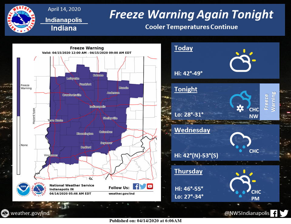
Cool temperatures will continue much of the week.
Today will be partly to mostly cloudy with highs in the 40s.
A freeze warning will be in effect again tonight, this time for all of central Indiana, with lows of 28-31 degrees expected.
There will be a chance for light snow showers in the far northwest late tonight.
Rain chances will continue into Wednesday with highs ranging from the low 40s north to the low 50s south.
Thursday will be a few degrees warmer with a chance for afternoon showers.
Via NWS Indianapolis. Follow them on Twitter @NWSIndianapolis for the latest Indianapolis area weather news.
AROUND TWITTER
COLD BLAST WITH SNOW CHANCES…
Unseasonably chilly air settles in as a few waves come through. A rain/snow combination in the set-up through Friday. Latest forecast #INwx @WTHRcom | https://t.co/VkQHW9Gc9g pic.twitter.com/Dmnm2y3E7n— Lindsey Monroe (@LindseyWTHR13) April 14, 2020
Our Tuesday is just getting started. I wanted to share the forecast as you get your day going. #INwx pic.twitter.com/KCf6Gw73OB
— Kyle Mounce (@kylemounce) April 14, 2020