Unsettled weather is expected later in the weekend.
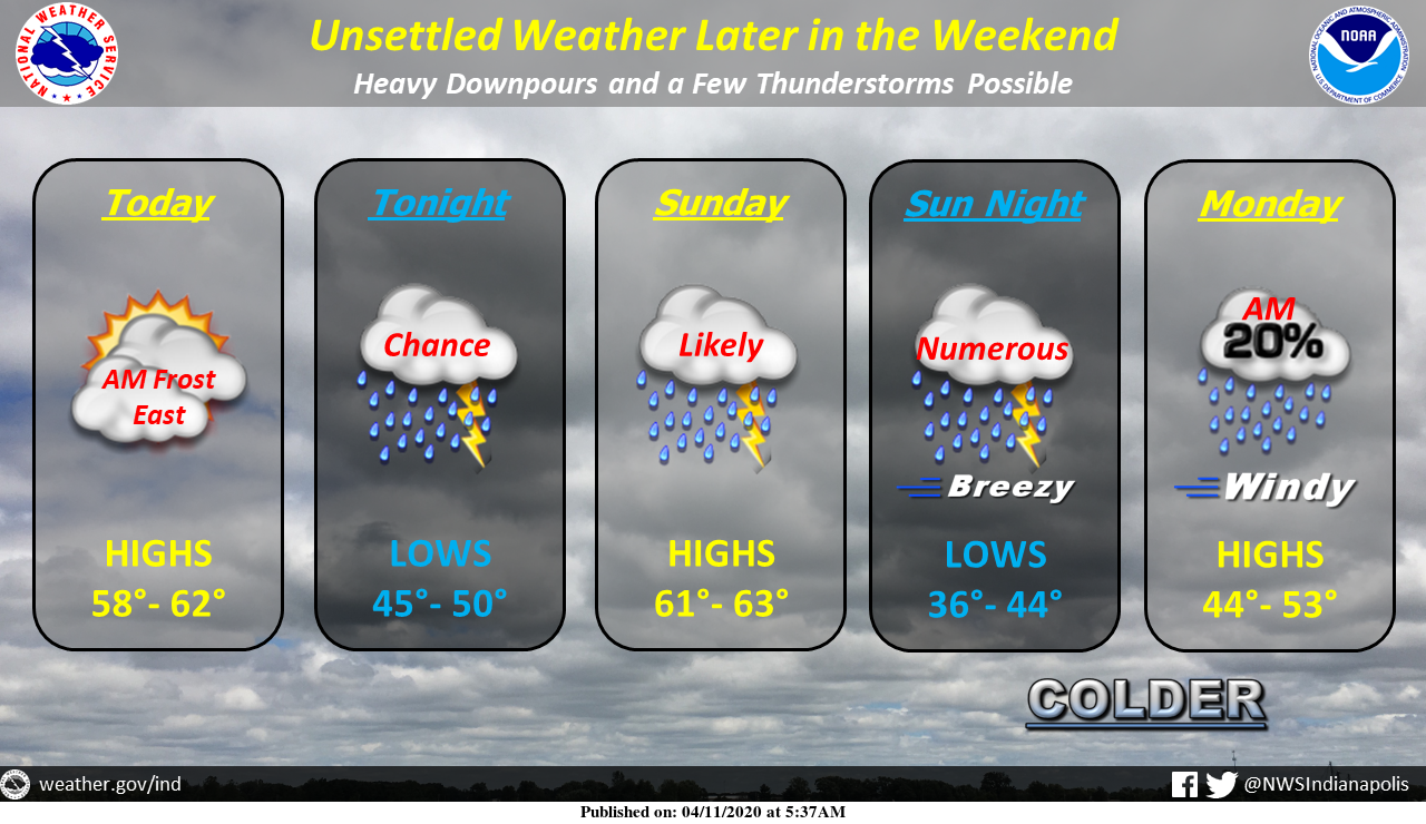
Today, expect partly to mostly cloudy skies, with some breaks in the clouds, particularly later in the day. Some frost will be possible across eastern portions of the area early. Highs will climb into the upper 50s to low 60s.
There will be a chance of showers and perhaps a thunderstorm tonight, with lows in the mid-40s to around 50.
Showers are likely Sunday, with a thunderstorm possible late in the day. Highs will be in the low 60s.
Numerous showers and a few thunderstorms are expected Sunday night, with heavy downpours and an isolated strong storm possible. Conditions will be breezy with temperatures dropping late behind a cold front. Lows will be in the mid-30s to mid-40s across the area.
Lingering morning showers will end by midday Monday, with mostly cloudy skies. Windy conditions are expected, with wind gusts as high as 45 MPH expected. Highs will be in the mid-40s to low 50s.
Via NWS Indianapolis. Follow them on Twitter @NWSIndianapolis for the latest Indianapolis area weather news.
AROUND TWITTER
How does a weekend warm-up sound? Highs in the 60s the next two days! @rtv6 #INwx pic.twitter.com/9HxXfBQXc8
— Kyle Mounce (@kylemounce) April 11, 2020
Remembering one of Indiana's deadliest tornado outbreaks…the Palm Sunday Tornado Outbreak happened 55 years ago today. 10 significant tornadoes hit the state including the infamous photo of the "Twins" of Dunlap: https://t.co/szgMUHcObc #INwx pic.twitter.com/2Y5cpNOMgs
— Sean Ash (@SeanAshWX) April 11, 2020