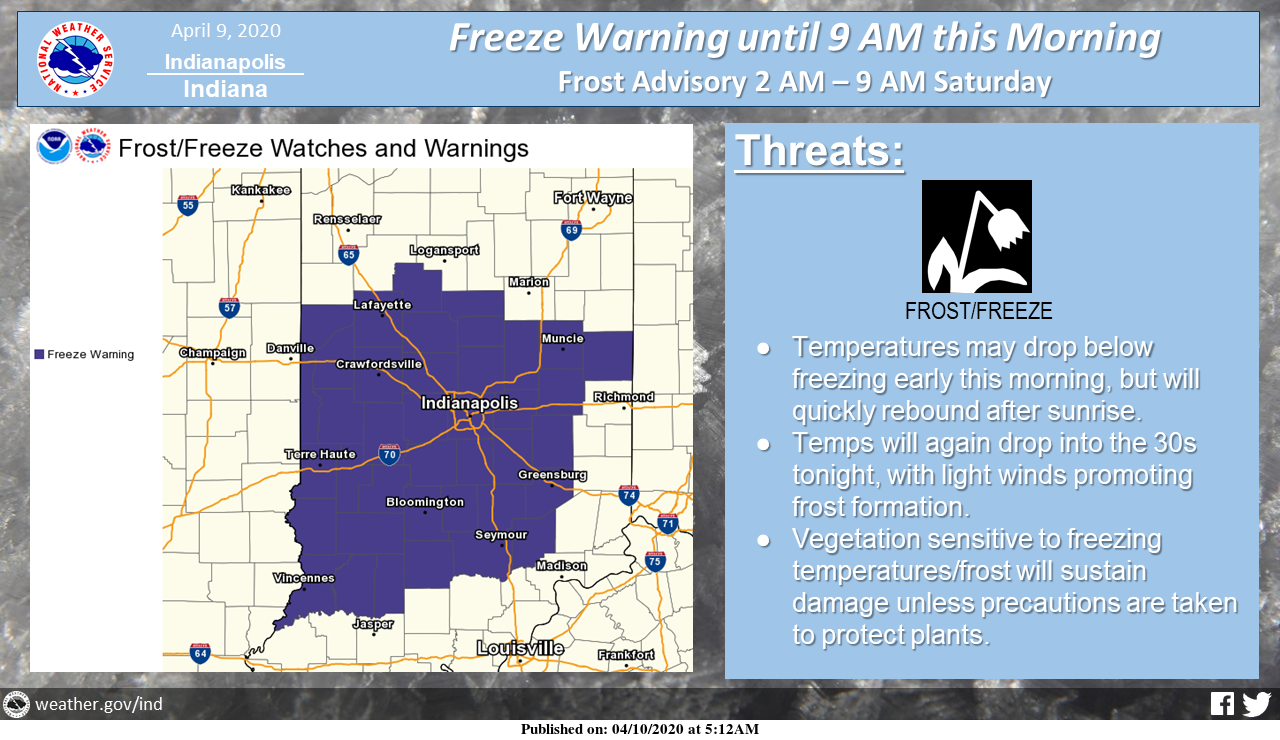
A freeze warning remains in effect across all of central Indiana through 9 AM.
Tonight into Saturday morning, temperatures will again drop into the 30s across the area but should remain above freezing. However, lighter winds tonight will promote frost formation.
Vegetation sensitive to frost or freeze will sustain damage without action to protect the plants.
Those with agricultural or horticultural interests should be aware that this threat will very likely return throughout next week, as well below normal temperatures remain the rule.
Via NWS Indianapolis. Follow them on Twitter @NWSIndianapolis for the latest Indianapolis area weather news.
AROUND TWITTER
Unsettled weather coming later this weekend, with showers and a few thunderstorms possible late Sat night into Sunday night. #INwx pic.twitter.com/CJkXYtKK8Z
— NWS Indianapolis (@NWSIndianapolis) April 10, 2020
It's finally Friday! Here's a check of the weather day ahead. #INwx pic.twitter.com/1GyjTEXnKM
— Kyle Mounce (@kylemounce) April 10, 2020
FREEZE WARNING in effect through 9 AM for much of central Indiana. Temperatures have dropped into the lower to mid-30s right now! #INwx @FOX59 @theWXauthority #FOX59morning pic.twitter.com/h09gnuOF7w
— Amber Hardwick (@AHardwickWx) April 10, 2020
Amber’s #Doodlecast >> It’s National Farm Animals Day! Cold and frosty start… But we will see mostly Sunny ☀️ skies today! High: 50°! #INwx @fox59 @thewxauthority #sketchforecast pic.twitter.com/6Y1YZyTnXc
— Amber Hardwick (@AHardwickWx) April 10, 2020
Happy Friday and Good Friday! A cooler day with lots of sunshine. Rain arrive late Saturday with possible severe storms Sunday. Take advantage of the dry and quiet weather today. @WISH_TV #INwx #Indy pic.twitter.com/oAV01wnvhL
— Stephanie Mead (@stephmeadwx) April 10, 2020